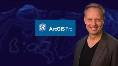
Teaching and Learning with GIS Technology
Joe Oswald
7:30:55
Description
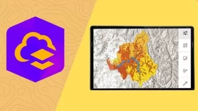
An Introduction to ArcGIS Online for Teachers
What You'll Learn?
- Students in this training course will learn what GIS is and how it can be used as a powerful educational tool for a variety of subject areas.
- Students will learn how GIS is a great tool for STEM, science, and history fair projects as well as presenting and analyzing various kinds of research data.
- Students will learn how to obtain free web-based ArcGIS Online software for themselves and their schools from the global leader is GIS technology.
- Students will learn important account settings for their ArcGIS software.
- Students will learn how to find ready-made activities and lesson plans for using GIS in the classroom for a variety of subject areas.
- Students will be introduced to powerful analysis tools in ArcGIS that can be used to analyze and chart data, help make decisions, and solve real-world problems.
- Students will learn how GIS visualization and spatial analysis can lead to a deeper understanding of content information and its context.
- Students will learn how GIS visualization and spatial analysis can be used to prove or disprove a hypothesis.
- Students will learn basic GIS terminology.
- Students will learn the basics of using ArcGIS Online including learning how to navigate the map viewer interface page.
- Students will learn how to build maps and add layers of information.
- Students will learn how to find and upload shapefiles.
- Students will learn how to plot single and multiple points.
- Students will learn how to create simple databases of points and accompanying information and upload them to a GIS map.
- Students will learn how to configure tables and pop-up windows to display additional information about features on a map.
- Students will learn how to use the location and measurement tools to find places, find longitude and latitude coordinates, and measure distance and area.
- Students will learn how to download waypoints collected from a GPS device or smartphone app and plot them on a GIS map...great for research and field work.
- Students will learn how to export maps to websites and smartphone apps.
- Students will learn which smartphone apps work with ArcGIS and GPS technologies.
- Students will learn how to create story maps with the ArcGIS StoryMaps application.
- Students will learn how GIS can be used in a business class to help find locations for a new business by analyzing demographic, economic, and geographic data.
- Students will be introduced to digitized historical maps.
- Students will be given numerous ideas on how teachers can use GIS mapping with their own students across the academic curriculum.
- Students will be given additional resources to guide them in using GIS.
Who is this for?
What You Need to Know?
More details
DescriptionCreated as a professional development course for educators or anyone else interested in learning GIS technology, teachers, administrators, parents, and others will learn the transformative power of GIS technology (Geographic Information System) for teaching and learning. Learn to use this cutting-edge technology to engage students while harnessing the power of visualization and spatial analysis to help students foster a deeper understanding of historical and contemporary events while enhancing students' technological and problem-solving skills. This course will explain how to obtain free ArcGIS Online software from the global leader in GIS technology as well as the basics of using the software and applying it to the teaching of many academic subjects. This course will also show participants how to find ready-made standards-based lesson plans for a variety of subject areas and introduce the user to the software's built-in spatial analysis tools. Step-by-step directions are contained in the video lectures and supplemental resources along with other resources for finding and downloading shapefiles and other GIS data. Basic GIS terminology will also be covered.
This is course is perfect for interdisciplinary and STEM education; inquiry and problem-based instruction; displaying & analyzing data; research, science, and history projects; economics & demographic applications; and real-world problem solving. Learn to create maps and export them to websites and smartphone apps for field work. Pair with GPS devices, smartphone apps, and Google Forms to collect data and import the data into your GIS application.
Using GIS technology across the curriculum targets the Next Generation Science Standards; Common Core standards for math, ELA, social studies, and other subjects; as well as Domains 1a, 1c, 1d, 1e, 3b, and 3c of the Danielson Framework for Teaching. The educational and professional applications are limitless. Recommended for educators working with 6th grade students through college.Â
This course is also great for anyone wanting to learn how to use ArcGIS Online.
Who this course is for:
- This course is primarily intended for teachers of all subject in areas from 6th grade through the graduate level to learn how to use and incorporate GIS technology into their instruction to help students foster a deeper understand of content material while enhancing inquiry and project-based instruction as well as problem-solving skills. While the primary audience for this course might be educators, anyone interested in learning more about GIS technology and how it is used in other professions will benefit from this course. Using GIS technology across the curriculum targets the Next Generation Science Standards; Common Core standards for math, ELA, social studies, and other subjects; as well as Domains 1a, 1c, 1d, 1e, 3b, and 3c of the Danielson Framework for Teaching.
Created as a professional development course for educators or anyone else interested in learning GIS technology, teachers, administrators, parents, and others will learn the transformative power of GIS technology (Geographic Information System) for teaching and learning. Learn to use this cutting-edge technology to engage students while harnessing the power of visualization and spatial analysis to help students foster a deeper understanding of historical and contemporary events while enhancing students' technological and problem-solving skills. This course will explain how to obtain free ArcGIS Online software from the global leader in GIS technology as well as the basics of using the software and applying it to the teaching of many academic subjects. This course will also show participants how to find ready-made standards-based lesson plans for a variety of subject areas and introduce the user to the software's built-in spatial analysis tools. Step-by-step directions are contained in the video lectures and supplemental resources along with other resources for finding and downloading shapefiles and other GIS data. Basic GIS terminology will also be covered.
This is course is perfect for interdisciplinary and STEM education; inquiry and problem-based instruction; displaying & analyzing data; research, science, and history projects; economics & demographic applications; and real-world problem solving. Learn to create maps and export them to websites and smartphone apps for field work. Pair with GPS devices, smartphone apps, and Google Forms to collect data and import the data into your GIS application.
Using GIS technology across the curriculum targets the Next Generation Science Standards; Common Core standards for math, ELA, social studies, and other subjects; as well as Domains 1a, 1c, 1d, 1e, 3b, and 3c of the Danielson Framework for Teaching. The educational and professional applications are limitless. Recommended for educators working with 6th grade students through college.Â
This course is also great for anyone wanting to learn how to use ArcGIS Online.
Who this course is for:
- This course is primarily intended for teachers of all subject in areas from 6th grade through the graduate level to learn how to use and incorporate GIS technology into their instruction to help students foster a deeper understand of content material while enhancing inquiry and project-based instruction as well as problem-solving skills. While the primary audience for this course might be educators, anyone interested in learning more about GIS technology and how it is used in other professions will benefit from this course. Using GIS technology across the curriculum targets the Next Generation Science Standards; Common Core standards for math, ELA, social studies, and other subjects; as well as Domains 1a, 1c, 1d, 1e, 3b, and 3c of the Danielson Framework for Teaching.
User Reviews
Rating

Joe Oswald
Instructor's Courses
Udemy
View courses Udemy- language english
- Training sessions 21
- duration 7:30:55
- Release Date 2024/07/21