Surface Geology : Mineral exploration planning
Mining Geologist
1:49:19
Description
Exploration tools in Micromine
What You'll Learn?
- Drillhole planning
- Manipulating GIS data in Micromine
- Geological Database creation
- Sample Data interpreation
- Basics of Micromine
Who is this for?
What You Need to Know?
More details
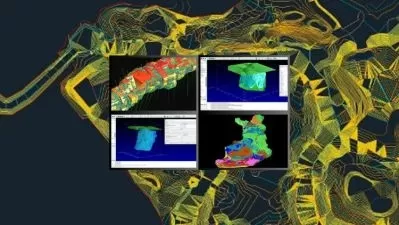
DescriptionMineral exploration typically begins by studying the near surface geology. Explorers use available maps, reports and data to search for prospective regions. The field work begins once the properties covering any identified areas have been acquired. In addition to traditional rock hammer and hand lens, exploration geologists toolkit includes electronic devices such as a GPS, digital structure compass a portable XRF scanner and many more these tools are use to collect data and samples from the field and they are carried to the office and loaded into the computer to be manipulated and interpreted for further planning and exploration. Usually the softwares to be used for this matter are GIS softwares ( Geographic information systems) like ArcGis and Qgis. In this course we will do all the GIS work in a Mining package which is Micromine which is used for any exploration scale analyses and explore some the features that this mining software has to offer when it comes to Mining exploration , we will cover things like manipulating GISÂ data, Planning Drillholes, Creating a surface flow map, Creating a Geological database and much more, this course will be updated with more lectures upon the request of the students to suits their needs.
Who this course is for:
- geologists
- mining engineers
- geoscientists
Mineral exploration typically begins by studying the near surface geology. Explorers use available maps, reports and data to search for prospective regions. The field work begins once the properties covering any identified areas have been acquired. In addition to traditional rock hammer and hand lens, exploration geologists toolkit includes electronic devices such as a GPS, digital structure compass a portable XRF scanner and many more these tools are use to collect data and samples from the field and they are carried to the office and loaded into the computer to be manipulated and interpreted for further planning and exploration. Usually the softwares to be used for this matter are GIS softwares ( Geographic information systems) like ArcGis and Qgis. In this course we will do all the GIS work in a Mining package which is Micromine which is used for any exploration scale analyses and explore some the features that this mining software has to offer when it comes to Mining exploration , we will cover things like manipulating GISÂ data, Planning Drillholes, Creating a surface flow map, Creating a Geological database and much more, this course will be updated with more lectures upon the request of the students to suits their needs.
Who this course is for:
- geologists
- mining engineers
- geoscientists
User Reviews
Rating

Mining Geologist
Instructor's Courses
Udemy
View courses Udemy- language english
- Training sessions 10
- duration 1:49:19
- English subtitles has
- Release Date 2024/05/08