Companies Home Search Profile

Spatial Analysis and Visualization with BigQuery GIS

Focused View

Calculated Systems

58:41

12 View
  • 1. Introduction.mp4
    01:52
  • 2. Geographic Information Systems.mp4
    07:42
  • 3. All About Maps.mp4
    06:17
  • 4. Introduction to BigQuery.mp4
    05:25
  • 5. BigQuery GIS- Working with Geography Data.mp4
    14:35
  • 6. Spatial Analysis.mp4
    12:04
  • 7. Visualizing BigQuery GIS Data.mp4
    06:26
  • 8. Integrating BigQuery with Python.mp4
    04:20
  • Description


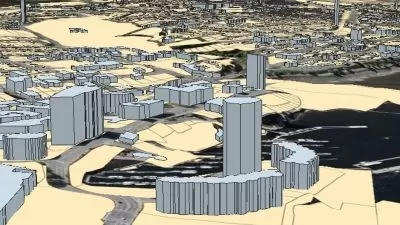
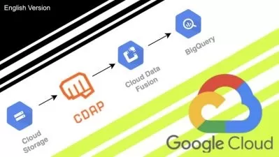
    This lesson explores geographic information system (GIS) topics and how to query and analyze GIS data within the database environment of BigQuery GIS. We'll start off by defining what GIS is, discussing some key GIS concepts, and introducing some common GIS data types.

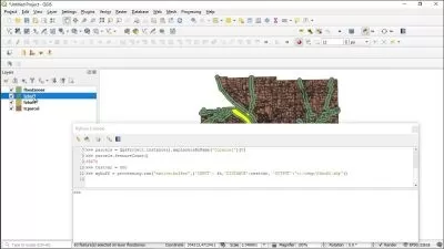
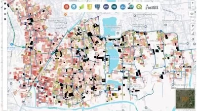
    We'll then move on to common types of maps and introduce the concept of map projections. You'll get an introduction to Google's BigQuery tool, and finally, we'll put all these topics together and look at how you can perform analysis and visualization using SQL and Python in conjunction with BigQuery GIS.

    If you have a use case analyzing and mapping geospatial data or anticipate one in the future, especially if your data is in a relational format (or already in BigQuery), then this lesson is ideal for you!

    Please feel free to contact us at [email protected] with any feedback you may have related to this lesson. 

    Learning Objectives

    • Learn about Google BigQuery GIS and its concepts, as well as common GIS data formats
    • Understand the common types of maps and the concept of map projections
    • Learn about spatial query functionality and spatial visualization
    • Understand how BigQuery GIS can be integrated with Python

    Intended Audience

    This lesson is intended for anyone who wants to:

    • Leverage BigQuery GIS for their geospatial analytics needs
    • Learn how to visualize data on maps

    Prerequisites

    To get the most out of this lesson, you should have basic familiarity with SQL, Python, and cloud computing, ideally Google Cloud Platform.

    More details


    User Reviews
    Rating
    0
    0
    0
    0
    0
    average 0
    Total votes0
    Focused display
    Category
    Calculated Systems
    Calculated Systems
    Instructor's Courses
    Calculated Systems was founded by experts in Hadoop, Google Cloud, and AWS. Calculated Systems enables code-free capture, mapping, and transformation of data in the cloud-based on Apache NiFi, an open-source project originally developed within the NSA. Calculated Systems accelerates time to market for new innovations while maintaining data integrity. With cloud automation tools, deep industry expertise, and experience productionalizing workloads development cycles are cut down to a fraction of their normal time. The ability to quickly develop large-scale data ingestion and processing decreases the risk companies face in long development cycles. Calculated Systems is one of the industry leaders in Big Data transformation and education of these complex technologies.
    Join thousands of users in achieving your personal goals through Cloud Academy. Score job-ready tech skills that you can practice in a real environment, without the risk of extra costs or making mistakes. It’s simply the smartest way to gain certifications and get career-ready.
    • language english
    • Training sessions 8
    • duration 58:41
    • Release Date 2024/04/27

    Courses related to GIS

    Courses related to Google BigQuery

    Subtitle
    BigQuery for Data Analysts
    Udemy Dan Sullivan
    Dan Sullivan
    BigQuery for Data Analysts
    4:56:21
    English subtitles
    03/03/2024