QGIS for Earth Observation and Geospatial Applications
Amit Daiman
7:57:02
Description
Remote Sensing and GIS applications for watershed and land use and land cover mapping
What You'll Learn?
- To educate land planners, water managers and students in Remote Sensing and GIS.
- Provide an opportunity to understand the raster and vector data, spatial analysis and feature extraction through open-source data and QGIS software.
- To make an expert in watershed modelling, land cover mapping, digital cartography and spectral indices.
- To provide good hands to Land planners, GIS analysist, water managers, geospatial technicians, and student.
Who is this for?
What You Need to Know?
More details
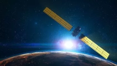
DescriptionThe course “QGIS for Earth Observation and Geospatial Applications†is designed for land planners, water managers, GIS community and hydrologists, professionals and students, and those who want to gain skills in Earth Observation (EO) and Geographic Information System (GIS) applications. The course structure provides QGIS software knowledge, especially digital cartography, spatial analysis, land cover mapping, and watershed delineation and allows one to understand the fundamentals of EO and GIS.
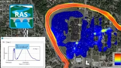
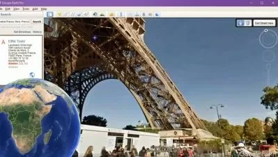
During the course, you will learn the fundamentals of EO, GIS, digital cartography, features of QGIS software, types of data, automated streams and watershed delineation, GIS data creation, spatial analysis, land cover mapping and spectral Indices mapping. This course can be used as independent study material and a geospatial instructor for professionals, experts and students, followed by course guidebooks and videos.
After this course, you will have an excessive understanding of geospatial data, including raster and vector data models, map composition, watershed development plans, watershed management, land use planning, and automated feature extraction (land use land cover mapping) of a large area from open-source satellite images. This course aims to provide real-time solutions for land planners, water managers, geospatial technicians, and students using open-source satellite data, GIS layers and QGIS software.
Who this course is for:
- Land planners, GIS analysist, water managers, geospatial technicians, and students.
The course “QGIS for Earth Observation and Geospatial Applications†is designed for land planners, water managers, GIS community and hydrologists, professionals and students, and those who want to gain skills in Earth Observation (EO) and Geographic Information System (GIS) applications. The course structure provides QGIS software knowledge, especially digital cartography, spatial analysis, land cover mapping, and watershed delineation and allows one to understand the fundamentals of EO and GIS.
During the course, you will learn the fundamentals of EO, GIS, digital cartography, features of QGIS software, types of data, automated streams and watershed delineation, GIS data creation, spatial analysis, land cover mapping and spectral Indices mapping. This course can be used as independent study material and a geospatial instructor for professionals, experts and students, followed by course guidebooks and videos.
After this course, you will have an excessive understanding of geospatial data, including raster and vector data models, map composition, watershed development plans, watershed management, land use planning, and automated feature extraction (land use land cover mapping) of a large area from open-source satellite images. This course aims to provide real-time solutions for land planners, water managers, geospatial technicians, and students using open-source satellite data, GIS layers and QGIS software.
Who this course is for:
- Land planners, GIS analysist, water managers, geospatial technicians, and students.
User Reviews
Rating
Amit Daiman
Instructor's Courses
Udemy
View courses Udemy- language english
- Training sessions 20
- duration 7:57:02
- Release Date 2022/12/03