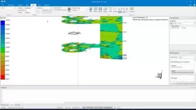
PLAXIS 2D for Beginners - Geotechnical Numerical Analysis
Mostafa Ismail
3:00:14
Description
Learn how to run PLAXIS 2D as a professional
What You'll Learn?
- Create A 2D Model in Plaxis from start to end
- Create retaining wall in the form of soldier pile or equivalent, with ground anchors
- Determine axial capacity of a single pile
- Run a saftey analysis and determine the factor of safety for a slope and deep excavation
Who is this for?
What You Need to Know?
More details
DescriptionCourse Contents
1. Introduction to PLXIS 2D (Plane strain versus Axi-symmetry models), borehole creation, soil creation, the input of soil parameters, and basic drawing tools
2. Tutorial 1: Slope stability analysis of an embankment, determination of safety factor (FoS) - Plane Strain
3. Explanation of Mohr-Coloumb (MC) and Hardening Soil constitutive models
4. Tutorial 2: Axial capacity of a single pile - Axi-symmetry model
5. Tutorial 3: Design of the retaining structure of a deep excavation consisting of soldier pile walls and prestressed ground anchors. This tutorial includes the application of dewatering and performing consolidation calculations.
In this comprehensive course tailored specifically for beginners, students will embark on an empowering journey into the world of geotechnical engineering software, focusing on the renowned PLAXIS 2D. Throughout this transformative learning experience, participants will acquire the fundamental knowledge and practical skills necessary to confidently navigate the complexities of PLAXIS 2D and embark on successful numerical modeling.
The course begins with a solid foundation, ensuring students grasp the essential concepts of building a numerical model. They will become familiar with the essential skills, setting the stage for a deeper understanding of PLAXIS 2D functionalities.
Students will dive into the software, exploring its intuitive user interface and gaining proficiency in model creation and manipulation. Through hands-on exercises, they will learn to efficiently generate meshes, analyze soil-structure interaction, and interpret modeling results and outputs. From foundational concepts such as boundary conditions and soil material models to advanced topics like slope stability assessments and dep excavations, participants will gain a holistic understanding of PLAXIS 2D's capabilities.
Moreover, the course will empower students to solve real-world geotechnical challenges. They will learn to simulate ground settlement, evaluate the stability of retaining walls, and analyze the behavior of soil-structure systems. Through comprehensive tutorials and practical examples, students will develop a problem-solving mindset and learn to make informed engineering decisions using PLAXIS 2D.
By the end of this empowering course, beginners will have gained a solid command of PLAXIS 2D, enabling them to embark on geotechnical projects with confidence. Armed with a deep understanding of modeling principles and hands-on experience with the software, students will be prepared to tackle complex geotechnical challenges, optimize designs, and contribute to the field of numerical modeling with excellence and proficiency. With this newfound expertise, students will be well-equipped to take their first steps toward a successful geotechnical engineering career, focusing on numerical analysis.
Who this course is for:
- Undergraduate Students
- Postgraduate Students
- Geotechnical Engineers
- Geotechnical Professionals
Course Contents
1. Introduction to PLXIS 2D (Plane strain versus Axi-symmetry models), borehole creation, soil creation, the input of soil parameters, and basic drawing tools
2. Tutorial 1: Slope stability analysis of an embankment, determination of safety factor (FoS) - Plane Strain
3. Explanation of Mohr-Coloumb (MC) and Hardening Soil constitutive models
4. Tutorial 2: Axial capacity of a single pile - Axi-symmetry model
5. Tutorial 3: Design of the retaining structure of a deep excavation consisting of soldier pile walls and prestressed ground anchors. This tutorial includes the application of dewatering and performing consolidation calculations.
In this comprehensive course tailored specifically for beginners, students will embark on an empowering journey into the world of geotechnical engineering software, focusing on the renowned PLAXIS 2D. Throughout this transformative learning experience, participants will acquire the fundamental knowledge and practical skills necessary to confidently navigate the complexities of PLAXIS 2D and embark on successful numerical modeling.
The course begins with a solid foundation, ensuring students grasp the essential concepts of building a numerical model. They will become familiar with the essential skills, setting the stage for a deeper understanding of PLAXIS 2D functionalities.
Students will dive into the software, exploring its intuitive user interface and gaining proficiency in model creation and manipulation. Through hands-on exercises, they will learn to efficiently generate meshes, analyze soil-structure interaction, and interpret modeling results and outputs. From foundational concepts such as boundary conditions and soil material models to advanced topics like slope stability assessments and dep excavations, participants will gain a holistic understanding of PLAXIS 2D's capabilities.
Moreover, the course will empower students to solve real-world geotechnical challenges. They will learn to simulate ground settlement, evaluate the stability of retaining walls, and analyze the behavior of soil-structure systems. Through comprehensive tutorials and practical examples, students will develop a problem-solving mindset and learn to make informed engineering decisions using PLAXIS 2D.
By the end of this empowering course, beginners will have gained a solid command of PLAXIS 2D, enabling them to embark on geotechnical projects with confidence. Armed with a deep understanding of modeling principles and hands-on experience with the software, students will be prepared to tackle complex geotechnical challenges, optimize designs, and contribute to the field of numerical modeling with excellence and proficiency. With this newfound expertise, students will be well-equipped to take their first steps toward a successful geotechnical engineering career, focusing on numerical analysis.
Who this course is for:
- Undergraduate Students
- Postgraduate Students
- Geotechnical Engineers
- Geotechnical Professionals
User Reviews
Rating
Mostafa Ismail
Instructor's Courses
Udemy
View courses Udemy- language english
- Training sessions 7
- duration 3:00:14
- Release Date 2023/08/24


