Companies Home Search Profile

Learning Pix4D Drone Mapping

Focused View

Paul Tice

3:43:14

119 View
  • 001 Drone mapping.mp4
    01:11
  • 002 What is photogrammetry .mp4
    02:36
  • 003 Getting Part 107 certified - sUAS remote pilot.mp4
    08:02
  • 004 Understanding airspace.mp4
    05:54
  • 005 Air Map.mp4
    05:54
  • 006 Which mapping drone and camera are right for you .mp4
    02:05
  • 007 Pix4Dbim - Mapper, fields, and model.mp4
    04:45
  • 008 Using the Pix4Dcapture app to choose a mission - Part 1.mp4
    07:17
  • 009 Using the Pix4Dcapture app to choose a mission - Part 2.mp4
    04:48
  • 010 Preflight checks.mp4
    04:26
  • 011 Downloading and naming your data.mp4
    03:10
  • 012 The mathematical model of Earth in Pix4D.mp4
    01:40
  • 013 Overview of Pix4D - Creating your first project.mp4
    01:50
  • 014 Coordinate systems and projections.mp4
    04:34
  • 015 Processing options template.mp4
    02:59
  • 016 The Pix4D Map View interface.mp4
    05:50
  • 017 Definitions - Densified point cloud, 3D textured mesh, DSM, DTM, and so on.mp4
    05:39
  • 018 Initial processing - General.mp4
    04:38
  • 019 Initial processing - Matching.mp4
    08:09
  • 020 Initial processing - Calibration.mp4
    04:31
  • 021 Creating the quality report.mp4
    05:14
  • 022 Quality checking your data.mp4
    03:57
  • 023 Processing the point cloud.mp4
    05:39
  • 024 Generating a 3D textured mesh.mp4
    08:34
  • 025 Advanced processing options.mp4
    04:15
  • 026 Processing DSM and orthomosaic.mp4
    07:11
  • 027 Additional outputs for DSM, orthomosaic, and index.mp4
    05:43
  • 028 Using the Index Calculator toolset.mp4
    04:53
  • 029 Choosing your output coordinate system.mp4
    01:15
  • 030 Uploading to the cloud for processing.mp4
    02:56
  • 031 GCP - Creating a high-precision project, part 1.mp4
    05:47
  • 032 GCP - Creating a high-precision project, part 2.mp4
    06:03
  • 033 GCP - Creating a high-precision project, part 3.mp4
    02:57
  • 034 GCP - Creating a high-precision project, part 4.mp4
    04:28
  • 035 GCP - Creating a high-precision project - rayCloud Editor.mp4
    03:32
  • 036 MTP - Enhancing precision through manual tie points.mp4
    03:53
  • 037 Splitting and merging large projects, part 1.mp4
    04:54
  • 038 Splitting and merging large projects, part 2.mp4
    07:16
  • 039 Splitting and merging large projects, part 3.mp4
    03:35
  • 040 Splitting and merging large projects, part 4.mp4
    05:40
  • 041 rayCloud interface and basic features.mp4
    04:46
  • 042 rayCloud editing.mp4
    04:39
  • 043 Annotation tools.mp4
    04:22
  • 044 Volume calculator.mp4
    05:24
  • 045 Mosaic Editor.mp4
    05:52
  • 046 Thermal mapping.mp4
    03:06
  • 047 AEC application - 3D scans and Pix4D.mp4
    04:51
  • 048 How to search for help and resources.mp4
    02:34
  • Ex Files Learning Pix4D Drone Mapping.zip
  • Description


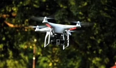
    Pix4D is a leader in small unmanned aerial system (sUAS or "drone") photogrammetry, building software that enables users to analyze complex image data and create orthomosaics and 3D models, all from photographs. With a drone, a camera, and the powerful processing engine in Pix4D, the science of photogrammetry is accessible to just about anyone. In this course, you can learn the basics of using Pix4D. Instructor Paul Tice explains how Pix4D pairs with different drones and cameras, and then shows how to program simple 2D missions for your drone with Pix4Dcapture. He then shows how to prepare for flight and retrieve the data and imagery once your drone has landed. In the last few chapters, Paul dives into Pix4D Desktop, where he shows how to process your data and produce outputs such as point clouds, 3D maps, and models. Plus, learn how to deal with large projects and turn the power of Pix4D onto architecture, engineering, and construction (AEC) data, such as 3D building scans.

    More details


    User Reviews
    Rating
    0
    0
    0
    0
    0
    average 0
    Total votes0
    Focused display
    LinkedIn Learning is an American online learning provider. It provides video courses taught by industry experts in software, creative, and business skills. It is a subsidiary of LinkedIn. All the courses on LinkedIn fall into four categories: Business, Creative, Technology and Certifications. It was founded in 1995 by Lynda Weinman as Lynda.com before being acquired by LinkedIn in 2015. Microsoft acquired LinkedIn in December 2016.
    • language english
    • Training sessions 48
    • duration 3:43:14
    • Release Date 2023/07/02

    Courses related to Filmmaking

    Courses related to Videography

    Subtitle
    How to Achieve a Cinematic Broadcast
    SkillShareHow to Achieve a Cinematic Broadcast
    1:22:22
    English subtitles
    01/14/2024
    Subtitle
    Food Videography Masterclass for Beginners
    Subtitle
    Spike Lee Teaches Independent Filmmaking

    Courses related to Cinematography