Leaflet From Scratch With A GeoDjango Project
Ikrom Nishanbaev
17:40:06
Description
Master Leaflet (JavaScript web mapping library), GeoDjango, Django REST, PostGIS, and build web mapping applications
What You'll Learn?
- All the Key Concepts of Leaflet
- Vector Layers in Leaflet including points, polylines, polygons, GeoJSON layers, markers, scalable vector graphics
- Styling Vector layers including basic styling, event based styling and others
- Raster layers, WMS and WFS layers
- Managing layers in Leaflet including GeoJSON
- Map projections and Coordinate Reference Systems
- Map controls and interactions
- Custom Leaflet plugin development
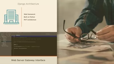
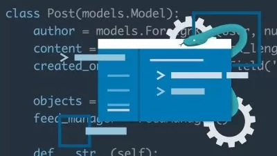
- Full stack web-GIS development with Leaflet, Django, GeoDjango, Django REST Framework, and PostGIS
- Learn and Build a Complete Web-GIS Project with Leaflet, Django, GeoDjango, Django REST Framework, and PostGIS
- And much much more
Who is this for?
More details
DescriptionLeaflet is an open source JavaScript front-end library that can be used to build interactive web mapping applications.
This course focuses on the latest version of the Leaflet (the course was recorded in 2023), and is the most comprehensive and modern Leaflet course you can find in UDEMY. It starts with very basics and goes all the way to advanced concepts. Once we master all the Leaflet concepts, we build a complete Leaflet project in the last section, which uses Leaflet at the front-end, and GeoDjango, Django REST framework and PostGIS at the back-end. For those who do not have Python programming experience, I provide a crash course on Python that covers the concepts you will need in the project development.
By the end of this course, you can build amazing web mapping applications using Leaflet.
More details about what the course covers
Introduction to Leaflet library
Setting up the environment
Simple map
Introduction to key concepts and components of Leaflet
Vector Layers in Leaflet including points, polylines, polygons, GeoJSON layers, markers, scalable vector graphics
Styling Vector layers including basic styling, event based styling and others
Raster layers, WMS and WFS layers
Managing layers in Leaflet including GeoJSON
Projections and Coordinate Reference Systems including different projections, coordinate transformations, and reprojecting of geospatial data
Map controls and interactions
Custom Leaflet plugin development
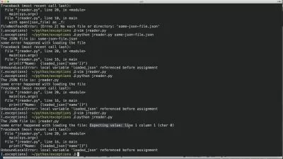
A crash course on Python (optional)
Full stack web-GIS development with Leaflet, Django, GeoDjango, Django REST Framework, and PostGIS
And much more!
Who this course is for:
- People that want to learn web mapping using Leaflet
- People interested in developing a web-GIS apps with Leaflet, Django, GeoDjango, Django REST framework, and PostGIS
- GIS (Geographic Information Science) professionals and students
Leaflet is an open source JavaScript front-end library that can be used to build interactive web mapping applications.
This course focuses on the latest version of the Leaflet (the course was recorded in 2023), and is the most comprehensive and modern Leaflet course you can find in UDEMY. It starts with very basics and goes all the way to advanced concepts. Once we master all the Leaflet concepts, we build a complete Leaflet project in the last section, which uses Leaflet at the front-end, and GeoDjango, Django REST framework and PostGIS at the back-end. For those who do not have Python programming experience, I provide a crash course on Python that covers the concepts you will need in the project development.
By the end of this course, you can build amazing web mapping applications using Leaflet.
More details about what the course covers
Introduction to Leaflet library
Setting up the environment
Simple map
Introduction to key concepts and components of Leaflet
Vector Layers in Leaflet including points, polylines, polygons, GeoJSON layers, markers, scalable vector graphics
Styling Vector layers including basic styling, event based styling and others
Raster layers, WMS and WFS layers
Managing layers in Leaflet including GeoJSON
Projections and Coordinate Reference Systems including different projections, coordinate transformations, and reprojecting of geospatial data
Map controls and interactions
Custom Leaflet plugin development
A crash course on Python (optional)
Full stack web-GIS development with Leaflet, Django, GeoDjango, Django REST Framework, and PostGIS
And much more!
Who this course is for:
- People that want to learn web mapping using Leaflet
- People interested in developing a web-GIS apps with Leaflet, Django, GeoDjango, Django REST framework, and PostGIS
- GIS (Geographic Information Science) professionals and students
User Reviews
Rating

Ikrom Nishanbaev
Instructor's Courses
Udemy
View courses Udemy- language english
- Training sessions 119
- duration 17:40:06
- Release Date 2023/03/09