Introduction to QGIS for remote sensing
Paul Nicoara,Ian Moffit
2:19:00
Description
Learn the basics of creating a great map in QGIS
What You'll Learn?
- Installation of QGIS software
- Everything required to know about vector data
- Processing vector data in QGIS
- Everything required to know about raster data
- Processing raster data in QGIS
- Introduction to remote sensing techniques
- Map layout design
Who is this for?
What You Need to Know?
More details
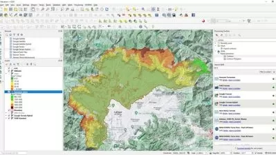
DescriptionThis course will teach you the basics of QGIS, starting with installing the software, importing data, and adapting the map settings and map format, to ensure you have a full vision of the features and capabilities of this software.
QGIS is a professional GIS application that is built on top of and proud to be itself Free and Open Source Software (FOSS).
QGIS is a user-friendly Open Source Geographic Information System (GIS) licensed under the GNU General Public License. QGIS is an official project of the Open Source Geospatial Foundation (OSGeo). It runs on Linux, Unix, Mac OSX, Windows, and Android and supports numerous vector, raster, and database formats and functionalities.
QGIS is a volunteer-driven project. They welcome contributions in the form of code contributions, bug fixes, bug reports, contributed documentation, and advocacy.
QGIS provides a continuously growing number of capabilities provided by core functions and plugins. You can visualize, manage, edit, analyze data, and compose printable maps.
Start your software journey with us, edit data, create your desired map and impress others with your result!
We love sharing our knowledge with the world and would like to say that we look forward to receiving all of your questions and feedback!
Who this course is for:
- Begginers in Geographical Information systems and science
- Natural science professionals
- Digital knowledge seekers
- Map makers amateurs
- Social science professionals
- Remote sensing professionals
This course will teach you the basics of QGIS, starting with installing the software, importing data, and adapting the map settings and map format, to ensure you have a full vision of the features and capabilities of this software.
QGIS is a professional GIS application that is built on top of and proud to be itself Free and Open Source Software (FOSS).
QGIS is a user-friendly Open Source Geographic Information System (GIS) licensed under the GNU General Public License. QGIS is an official project of the Open Source Geospatial Foundation (OSGeo). It runs on Linux, Unix, Mac OSX, Windows, and Android and supports numerous vector, raster, and database formats and functionalities.
QGIS is a volunteer-driven project. They welcome contributions in the form of code contributions, bug fixes, bug reports, contributed documentation, and advocacy.
QGIS provides a continuously growing number of capabilities provided by core functions and plugins. You can visualize, manage, edit, analyze data, and compose printable maps.
Start your software journey with us, edit data, create your desired map and impress others with your result!
We love sharing our knowledge with the world and would like to say that we look forward to receiving all of your questions and feedback!
Who this course is for:
- Begginers in Geographical Information systems and science
- Natural science professionals
- Digital knowledge seekers
- Map makers amateurs
- Social science professionals
- Remote sensing professionals
User Reviews
Rating
Paul Nicoara
Instructor's CoursesIan Moffit
Instructor's Courses
Udemy
View courses Udemy- language english
- Training sessions 10
- duration 2:19:00
- Release Date 2022/12/03


