GNSS GPS IMU INS Sensors - for ADAS and Autonomous Vehicles
Suchit Kr
10:53:24
Description
D-GNSS, DGPS, RTK, PPP, SBAS, GBAS, AHRS, Accelerometer, Gyroscope, Magnetometer, Python, fusion, Raspberry-pi 4
What You'll Learn?
- GNSS (Global Navigation Satellite Systems) in detail together with its role in ADAS and Autonomous vehicle test and development
- Hands on with GPS sensor and raspberry pi 4 using python to receive real-time GPS data
- Exploring various applications of GNSS based systems in automotive and non-automotive industry
- Hands on with 3 axis accelerometer and 3 axis gyroscope with raspberry pi 4 and python
- GNSS based correction methods - Differential GNSS, DGPS, SBAS, GBAS, RTK, PPP in detail
- Foundation of accelerometer, gyroscope and magnetometer with mathematical insights
- Understanding IMU - Inertial Measurement Unit and its importance in INS (Inertial Navigation System)
- Getting deeper (only theoretical) into GNSS and INS based fusion using Kalman filter based approaches.
- Details of AHRS (Attitude and Heading Reference System) and Dual GNSS / INS system
- Multiple case-studies covering various fusion techniques (theoritical) and applications with GNSS and INS
- Additional reference material in form of research litertures and web-links
- By the end of this course, you will be confident to use GNSS/INS based sensor system for your ADAS / Autonomous vehicle test and validation in your work.
Who is this for?
More details
DescriptionSensors are an indispensable part of Advanced Driver Assistance Systems (ADAS) and Autonomous Driving (AD) Technology. Sensors - like cameras, radar, lidar and ultrasonic are well known to all. These sensors are used to do external environmental perception around the vehicle and in some cases also to do in-vehicle perception.
GNSS (Global Navigation Satellite System), GPS (Global Position System) together with INS (Inertial Navigation System) are used to find the location of the ego vehicle itself. These sensors are used for multiple applications in the ADAS and the AD industry. These applications include but are not limited to:
1. Localization of vehicles on the road
2. To generate ground truth data for sensor perception (radar, lidar, camera) validation
3. To generate ground truth data for sensor fusion validation
4. For validation of various ADAS functions in the deterministic test sites
5. For using the GNSS/GPS highly accurate time - as a reference clock to synchronize (using NTP, PTP or gPTP) multi-sensor systems for algorithm development.
6. In V2X (Vehicle to Other) and V2V (Vehicle to Vehicle) applications.
and many more.......
GNSS/GPS + INS sensors also have multiple applications in various non-automotive fields like Navigation with mobile phones and cars, in Rail transport - to track locomotives, in aviation - for aircraft navigation from departure to landing, in marine - to track and navigate ships, in Port Automation, Precise Agriculture, Surface mining, Surveying, Drones, Smart Infrastructure application, etc
As GPS/GNSS alone cannot provide centimetre-level accuracy (which is necessary for ADAS and AD applications), various add-on technologies are used
1. DGNSS (Differential GNSS)
2. DGPS (Differential GPS)
3. SBAS (Satellite Based Augmentation System)
4. GBAS (Ground Based Augmentation System)
5. RTKÂ (Real Time Kinematic)
6. PPPÂ (Point Precision Positioning)
Moreover, Inertial Navigation Sensors - Accelerometer, Gyroscope and Magnetometer are also used with GPS /GNSS for better localization and accurate measurement, especially in situations where a GNSS signal is unavailable. This includes
1. Inertial Navigation systems (INS),Â
2. GNSS-aided INS system,
3. AHRS (Attitude and Heading Reference System),
4. Dual GNSS (or GNSS compass) -aided INS system.
In this course, you will learn all of the above-stated technologies so that you will be able to use them in your work and/or projects. In addition, hands-on practice in measuring real-time GPS and IMU data using low-cost sensors with raspberry pi 4 and python3 is included.
Through this complete course which consists of 11 hours of videos, you will learn
Basics of ADAS (Advanced Driver Assistance systems) with some examples
Basics of AD (Autonomous Driving) together with SAE levels of automation
Brief understanding of various sensors like Radar, lidar, camera, and ultrasonic used in ADAS and AD.
Lots of applications covering the usage of GNSS + INS sensors in ADAS and AD industry as well as non-automotive domains
Various GNSS + INS devices available in the market (ranging from high cost to low cost)
Deeply understanding GNSS technology, signal processing, pseudo-range calculation, trilateration, GNSS errors, different ways to overcome these errors
Various types of coordinate systems and frames used in GNSS technology
What are latitude and longitude? Different ways to represent them and their inter-conversions
NMEA-0183 message structures for GPS measurement
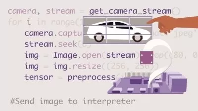
Real-time GPS measurement using a low-cost GPS device, raspberry pi 4 and python 3.
Various Differential correction methods - DGNSS, DGPS, SBAS, GBAS, RTK, PPP
Understanding IMU (Inertial Measurement Unit) and then deep dive into the working of accelerometer, gyroscope and magnetometer
Real-time IMU measurement using a low-cost IMU with raspberry pi 4 and python 3
Understanding INS (Inertial Navigation System) using a case study of pedestrian dead reckoning using INS
Deep dive into AHRS (Attitude and Heading reference system), GNSS-aided INS technology and Dual GNSS-aided INS technology.
Further case studies were taken from research papers to understand applications of GNSS and INS (along with other sensors) in ADAS, AD and robotics.
Note: This course focuses more on understanding the concepts and provides insights into various technologies in this domain hence programming is intentionally kept to a minimum.
Disclaimer: All the reference videos taken from various sources are only used for educational purposes and there is no intention to infringe copyright.
Who this course is for:
- Anyone interested to learn and understand GNSS INS based measurement technology use for position, speed, time and heading estimation
- People involved in ADAS and Autonomous vehicle development - it is highly recommended to do this course
Sensors are an indispensable part of Advanced Driver Assistance Systems (ADAS) and Autonomous Driving (AD) Technology. Sensors - like cameras, radar, lidar and ultrasonic are well known to all. These sensors are used to do external environmental perception around the vehicle and in some cases also to do in-vehicle perception.
GNSS (Global Navigation Satellite System), GPS (Global Position System) together with INS (Inertial Navigation System) are used to find the location of the ego vehicle itself. These sensors are used for multiple applications in the ADAS and the AD industry. These applications include but are not limited to:
1. Localization of vehicles on the road
2. To generate ground truth data for sensor perception (radar, lidar, camera) validation
3. To generate ground truth data for sensor fusion validation
4. For validation of various ADAS functions in the deterministic test sites
5. For using the GNSS/GPS highly accurate time - as a reference clock to synchronize (using NTP, PTP or gPTP) multi-sensor systems for algorithm development.
6. In V2X (Vehicle to Other) and V2V (Vehicle to Vehicle) applications.
and many more.......
GNSS/GPS + INS sensors also have multiple applications in various non-automotive fields like Navigation with mobile phones and cars, in Rail transport - to track locomotives, in aviation - for aircraft navigation from departure to landing, in marine - to track and navigate ships, in Port Automation, Precise Agriculture, Surface mining, Surveying, Drones, Smart Infrastructure application, etc
As GPS/GNSS alone cannot provide centimetre-level accuracy (which is necessary for ADAS and AD applications), various add-on technologies are used
1. DGNSS (Differential GNSS)
2. DGPS (Differential GPS)
3. SBAS (Satellite Based Augmentation System)
4. GBAS (Ground Based Augmentation System)
5. RTKÂ (Real Time Kinematic)
6. PPPÂ (Point Precision Positioning)
Moreover, Inertial Navigation Sensors - Accelerometer, Gyroscope and Magnetometer are also used with GPS /GNSS for better localization and accurate measurement, especially in situations where a GNSS signal is unavailable. This includes
1. Inertial Navigation systems (INS),Â
2. GNSS-aided INS system,
3. AHRS (Attitude and Heading Reference System),
4. Dual GNSS (or GNSS compass) -aided INS system.
In this course, you will learn all of the above-stated technologies so that you will be able to use them in your work and/or projects. In addition, hands-on practice in measuring real-time GPS and IMU data using low-cost sensors with raspberry pi 4 and python3 is included.
Through this complete course which consists of 11 hours of videos, you will learn
Basics of ADAS (Advanced Driver Assistance systems) with some examples
Basics of AD (Autonomous Driving) together with SAE levels of automation
Brief understanding of various sensors like Radar, lidar, camera, and ultrasonic used in ADAS and AD.
Lots of applications covering the usage of GNSS + INS sensors in ADAS and AD industry as well as non-automotive domains
Various GNSS + INS devices available in the market (ranging from high cost to low cost)
Deeply understanding GNSS technology, signal processing, pseudo-range calculation, trilateration, GNSS errors, different ways to overcome these errors
Various types of coordinate systems and frames used in GNSS technology
What are latitude and longitude? Different ways to represent them and their inter-conversions
NMEA-0183 message structures for GPS measurement
Real-time GPS measurement using a low-cost GPS device, raspberry pi 4 and python 3.
Various Differential correction methods - DGNSS, DGPS, SBAS, GBAS, RTK, PPP
Understanding IMU (Inertial Measurement Unit) and then deep dive into the working of accelerometer, gyroscope and magnetometer
Real-time IMU measurement using a low-cost IMU with raspberry pi 4 and python 3
Understanding INS (Inertial Navigation System) using a case study of pedestrian dead reckoning using INS
Deep dive into AHRS (Attitude and Heading reference system), GNSS-aided INS technology and Dual GNSS-aided INS technology.
Further case studies were taken from research papers to understand applications of GNSS and INS (along with other sensors) in ADAS, AD and robotics.
Note: This course focuses more on understanding the concepts and provides insights into various technologies in this domain hence programming is intentionally kept to a minimum.
Disclaimer: All the reference videos taken from various sources are only used for educational purposes and there is no intention to infringe copyright.
Who this course is for:
- Anyone interested to learn and understand GNSS INS based measurement technology use for position, speed, time and heading estimation
- People involved in ADAS and Autonomous vehicle development - it is highly recommended to do this course
User Reviews
Rating

Suchit Kr
Instructor's Courses
Udemy
View courses Udemy- language english
- Training sessions 56
- duration 10:53:24
- Release Date 2023/04/10


![[New] Master Class Python Programming for non-programmers](https://traininghub.ir/image/course_pic/37291-x225.webp)