Geospatial Data Analyses & Remote Sensing: 5 Classes in 1
Kate Alison
8:47:07
Description
Learn Remote Sensing, QGIS & GIS , main concepts, machine learning, QGIS classification, change detection, Earth Engine
What You'll Learn?
- Understand and implement basic concepts of Geographic Information Systems (GIS) and Remote Sensing
- Fully understand the basics of Land use and Land Cover (LULC) Mapping and Change Detection in QGIS
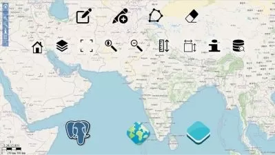
- Learn the most popular open-source GIS and Remote Sensing software tools (QGIS), Semi-automated classification (SCP) plugin, OTB toolbox)
- Learn how to obtain satellite data, apply image preprocessing, create training and validation data in QGIS
- Create your first GIS maps for your reports/presentations in QGIS
- Understand machine learning concepts and its application in GIS and Remote Sensing
- Apply Machine Learning image classification mapping and change detection in SCP, OTB toolbox and QGIS
- Fully understand and apply advanced methods in machine learning in GIS and Remote Sensing, such as random forest classification and object-based image analysis,
- You'll have a copy of the labs, step-by-step manuals and scripts used in the course for QGIS & more
Who is this for?
What You Need to Know?
More details
DescriptionGeospatial Analyses & Remote Sensing : from Beginner to Pro
Are you struggling to create GIS or satellite imagery-based maps for your Remote Sensing or GIS project? Do terms like Remote Sensing object-based image analysis, machine learning, QGIS, or Google Earth Engine sound daunting? Are you seeking a practical course that guides you through the concepts and helps you embark on real-life GIS mapping projects?
Welcome to our Practical Geospatial Masterclass, combining the content of four separate courses into one comprehensive learning experience. With over nine hours of video content, hands-on exercises, and downloadable materials, this course equips you with the knowledge and skills required for practical geospatial analysis. You'll learn to perform tasks such as land use and land cover mapping, change detection, machine learning for GIS, data manipulation, and map creation, all using popular and FREE software tools.
Course Highlights:
Comprehensive theoretical and practical geospatial knowledge
Application of Machine Learning in GIS and Remote Sensing
Land use and land cover mapping
Object-based image analysis
Data processing and map creation
Practical exercises with QGIS and Google Earth Engine
Course Focus:
This masterclass is designed to empower you with both theoretical and practical geospatial analysis skills, covering Remote Sensing, Geographic Information Systems (GIS), and Machine Learning applications in GIS and Remote Sensing technology. By course completion, you'll have a strong understanding of Remote Sensing and GIS fundamentals, Machine Learning applications in geospatial tasks, and the use of Machine Learning algorithms for land use and land cover mapping and object-based image analysis. Additionally, you'll be well-prepared to perform geospatial and Remote Sensing analysis using open source and free software tools.
What You'll Learn:
Practical use of Machine Learning algorithms in QGIS
Downloading and processing satellite imagery
Supervised and unsupervised learning
Accuracy assessment and change detection
Object-based image analysis
Cloud computing and Big Data analysis using Google Earth Engine
Who Should Enroll:
This course is ideal for professionals including geographers, programmers, social scientists, geologists, GIS & Remote Sensing experts, and anyone seeking to enhance their GIS and Remote Sensing skills. Whether you're a novice or looking to advance your knowledge in Machine Learning for GIS and Remote Sensing, this course provides the confidence and skills needed to tackle geospatial challenges.
INCLUDED IN THE COURSE: Gain access to precise instructions, downloadable practical materials, scripts, and datasets for hands-on geospatial analysis using QGIS and Google Earth Engine. Enroll today to unlock the power of practical geospatial analysis!
Who this course is for:
- Geographers, Programmers, geologists, biologists, social scientists, or everyone who deals with GIS maps in their field or would like to learn GIS and Remote Sensing
Geospatial Analyses & Remote Sensing : from Beginner to Pro
Are you struggling to create GIS or satellite imagery-based maps for your Remote Sensing or GIS project? Do terms like Remote Sensing object-based image analysis, machine learning, QGIS, or Google Earth Engine sound daunting? Are you seeking a practical course that guides you through the concepts and helps you embark on real-life GIS mapping projects?
Welcome to our Practical Geospatial Masterclass, combining the content of four separate courses into one comprehensive learning experience. With over nine hours of video content, hands-on exercises, and downloadable materials, this course equips you with the knowledge and skills required for practical geospatial analysis. You'll learn to perform tasks such as land use and land cover mapping, change detection, machine learning for GIS, data manipulation, and map creation, all using popular and FREE software tools.
Course Highlights:
Comprehensive theoretical and practical geospatial knowledge
Application of Machine Learning in GIS and Remote Sensing
Land use and land cover mapping
Object-based image analysis
Data processing and map creation
Practical exercises with QGIS and Google Earth Engine
Course Focus:
This masterclass is designed to empower you with both theoretical and practical geospatial analysis skills, covering Remote Sensing, Geographic Information Systems (GIS), and Machine Learning applications in GIS and Remote Sensing technology. By course completion, you'll have a strong understanding of Remote Sensing and GIS fundamentals, Machine Learning applications in geospatial tasks, and the use of Machine Learning algorithms for land use and land cover mapping and object-based image analysis. Additionally, you'll be well-prepared to perform geospatial and Remote Sensing analysis using open source and free software tools.
What You'll Learn:
Practical use of Machine Learning algorithms in QGIS
Downloading and processing satellite imagery
Supervised and unsupervised learning
Accuracy assessment and change detection
Object-based image analysis
Cloud computing and Big Data analysis using Google Earth Engine
Who Should Enroll:
This course is ideal for professionals including geographers, programmers, social scientists, geologists, GIS & Remote Sensing experts, and anyone seeking to enhance their GIS and Remote Sensing skills. Whether you're a novice or looking to advance your knowledge in Machine Learning for GIS and Remote Sensing, this course provides the confidence and skills needed to tackle geospatial challenges.
INCLUDED IN THE COURSE: Gain access to precise instructions, downloadable practical materials, scripts, and datasets for hands-on geospatial analysis using QGIS and Google Earth Engine. Enroll today to unlock the power of practical geospatial analysis!
Who this course is for:
- Geographers, Programmers, geologists, biologists, social scientists, or everyone who deals with GIS maps in their field or would like to learn GIS and Remote Sensing
User Reviews
Rating

Kate Alison
Instructor's Courses
Udemy
View courses Udemy- language english
- Training sessions 60
- duration 8:47:07
- Release Date 2023/12/16