Exploring Spatial Information using ArcGIS Pro
Graeme Browning
8:33:30
Description
ArcGIS Pro is the latest in-demand skill for GIS Professionals that you can master using this highly structured course!
What You'll Learn?
- ArcGIS Pro
- Desktop GIS
- Exploring Spatial Information
Who is this for?
What You Need to Know?
More details
DescriptionArcGIS Pro is Esri’s flagship desktop GIS product, and it was first released in 2015.
This course is being released at ArcGIS Pro 2.5. It is designed for those who are new to ArcGIS Pro, and also for those who just want to learn more about how to use ArcGIS Pro for exploring spatial data.
The scope of this particular course may touch upon, but excludes in depth examination of large topics like editing spatial data, making maps and map series using layouts, and geoprocessing using tools, models, tasks and the ArcPy module for Python. There is already a full length companion course already available for ArcPy (ArcPy for Python Developers using ArcGIS Pro) and a short companion course available for map series (Map Series made easy using ArcGIS Pro), while companion courses for the other topics are in development.
Most sections of this course can be taken in any order. You just need to download the data, and check that you have ArcGIS Pro working first.
The course requires only a Basic level license of ArcGIS Desktop (which includes ArcGIS Pro), and no extension products need to be licensed, in order to complete all exercises.
If you do not have an ArcGIS Desktop license then, for about $100-150 per annum, it is possible to use an Advanced level license and many of the extension products for non-commercial purposes (like taking this course!), via Esri’s ArcGIS for Personal Use program.
It is also possible to undertake a 21-day free trial of ArcGIS Pro.
The course takes an in-depth tour of the most commonly used ArcGIS Pro features for exploring spatial information. The scenarios chosen to illustrate how each feature is used are derived from the presenter’s experience working with ArcGIS Pro for 5 years, and with Esri software for more than 30 years.
In this 8.5 hour course of 52 lectures, which is suitable for English-speaking students from anywhere in the world, things that you will use and learn include:
Downloading Natural Earth Data
Starting ArcGIS Pro to check its version
Creating Projects
Using Start, Help and Project Pages
User Interface for working with projects
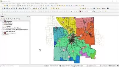
Exploring 2D Maps using Zoom, Pan, etc tools
Using Pop-ups to identify features
Using Bookmarks
Changing scale and setting scale dependent visibility and symbology
Filtering features using Definition Queries
Working with Selections using attributes and locations
Measuring and Snapping
Using Contents pane
Working with Layer Groups
Symbolizing Layers using Single Symbols, Unique Values, Graduated Colors and Symbols, Charts, Heat Maps, etc
Symbolizing Layers using Attribute-driven Color
Using Transparency, Swipe and Flicker Effects
Layer Properties like Metadata, Source, Selection, Joins and Relates, Time and Range
Configuring MapTips
Map Properties like Extent, Clip Layers, Coordinate Systems, and Metadata
Working with 3D Scenes (Local and Global)
Using Camera Properties and Navigator Controls
Converting and Linking Map and Scene Views
Plus much more.
Who this course is for:
- Beginners who may never have started ArcGIS Pro
- Existing ArcGIS Pro users who want to learn new and alternative ways to do things
ArcGIS Pro is Esri’s flagship desktop GIS product, and it was first released in 2015.
This course is being released at ArcGIS Pro 2.5. It is designed for those who are new to ArcGIS Pro, and also for those who just want to learn more about how to use ArcGIS Pro for exploring spatial data.
The scope of this particular course may touch upon, but excludes in depth examination of large topics like editing spatial data, making maps and map series using layouts, and geoprocessing using tools, models, tasks and the ArcPy module for Python. There is already a full length companion course already available for ArcPy (ArcPy for Python Developers using ArcGIS Pro) and a short companion course available for map series (Map Series made easy using ArcGIS Pro), while companion courses for the other topics are in development.
Most sections of this course can be taken in any order. You just need to download the data, and check that you have ArcGIS Pro working first.
The course requires only a Basic level license of ArcGIS Desktop (which includes ArcGIS Pro), and no extension products need to be licensed, in order to complete all exercises.
If you do not have an ArcGIS Desktop license then, for about $100-150 per annum, it is possible to use an Advanced level license and many of the extension products for non-commercial purposes (like taking this course!), via Esri’s ArcGIS for Personal Use program.
It is also possible to undertake a 21-day free trial of ArcGIS Pro.
The course takes an in-depth tour of the most commonly used ArcGIS Pro features for exploring spatial information. The scenarios chosen to illustrate how each feature is used are derived from the presenter’s experience working with ArcGIS Pro for 5 years, and with Esri software for more than 30 years.
In this 8.5 hour course of 52 lectures, which is suitable for English-speaking students from anywhere in the world, things that you will use and learn include:
Downloading Natural Earth Data
Starting ArcGIS Pro to check its version
Creating Projects
Using Start, Help and Project Pages
User Interface for working with projects
Exploring 2D Maps using Zoom, Pan, etc tools
Using Pop-ups to identify features
Using Bookmarks
Changing scale and setting scale dependent visibility and symbology
Filtering features using Definition Queries
Working with Selections using attributes and locations
Measuring and Snapping
Using Contents pane
Working with Layer Groups
Symbolizing Layers using Single Symbols, Unique Values, Graduated Colors and Symbols, Charts, Heat Maps, etc
Symbolizing Layers using Attribute-driven Color
Using Transparency, Swipe and Flicker Effects
Layer Properties like Metadata, Source, Selection, Joins and Relates, Time and Range
Configuring MapTips
Map Properties like Extent, Clip Layers, Coordinate Systems, and Metadata
Working with 3D Scenes (Local and Global)
Using Camera Properties and Navigator Controls
Converting and Linking Map and Scene Views
Plus much more.
Who this course is for:
- Beginners who may never have started ArcGIS Pro
- Existing ArcGIS Pro users who want to learn new and alternative ways to do things
User Reviews
Rating

Graeme Browning
Instructor's Courses
Udemy
View courses Udemy- language english
- Training sessions 52
- duration 8:33:30
- English subtitles has
- Release Date 2023/08/15


![Construction Sequence of a Real Life Project [Crash Course]](https://traininghub.ir/image/course_pic/28616-x225.webp)