ChatGPT make me scripts in seconds for Google Earth Engine
ArcGeek ®,Franz Pucha Cofrep
34:20
Description
Using ChatGPT 4o to create Google Earth Engine (GEE) scripts without needing programming knowledge
What You'll Learn?
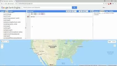
- Understand the Basics of Google Earth Engine (GEE): Learn how to navigate and utilize the GEE platform, including its interface and key functionalities.
- Create Basic Scripts with ChatGPT: Gain the ability to generate scripts for GEE using ChatGPT, simplifying complex coding tasks.
- Visualize and Analyze Earth Data: Develop skills to create maps and charts, and analyze satellite imagery and other geospatial data.
- Adapt and Improve Existing Code: Learn how to modify and enhance existing GEE scripts to better suit specific project needs and improve functionality.
Who is this for?
What You Need to Know?
More details
DescriptionWelcome to "ChatGPT: Make Me Scripts in Seconds for Google Earth Engine"! This comprehensive and beginner-friendly course empowers you to unlock the potential of Google Earth Engine (GEE) using Chat GPT 4o. No prior programming knowledge is required!
Chat GPT 4o acts as your personal GEE script assistant, translating your natural language instructions into powerful scripts. You'll quickly learn to:
Visualize Earth Data: Create captivating maps and charts using GEE's vast library of satellite imagery and datasets.
Combine Layers: Overlay different datasets to uncover hidden patterns and relationships.
Explore Your Environment: Analyze your local area or any region on Earth.
Automate Tasks: Save time by automating repetitive data processing tasks with ease.
This course is ideal for:
Students & Educators: Gain valuable skills in Earth science and data analysis.
Environmental Enthusiasts: Monitor environmental changes and explore sustainability solutions.
Geospatial Professionals: Lay the groundwork for more advanced GEE applications.
Anyone Curious About Our Planet: Discover the fascinating world of Earth data!
Imagine the possibilities! With Chat GPT 4o as your guide, GEE becomes a user-friendly tool for anyone eager to explore the world through the lens of data. This course removes the coding barrier, opening the door to a world of discovery and innovation.
Who this course is for:
- Anyone Curious About Our Planet: Who wants to discover the fascinating world of Earth data.
- Students and Educators: Who want to gain skills in Earth science and data analysis.
- Environmental Enthusiasts: Who are interested in monitoring environmental changes and exploring sustainability solutions.
- Geospatial Professionals: Who wish to lay the groundwork for more advanced GEE applications.
Welcome to "ChatGPT: Make Me Scripts in Seconds for Google Earth Engine"! This comprehensive and beginner-friendly course empowers you to unlock the potential of Google Earth Engine (GEE) using Chat GPT 4o. No prior programming knowledge is required!
Chat GPT 4o acts as your personal GEE script assistant, translating your natural language instructions into powerful scripts. You'll quickly learn to:
Visualize Earth Data: Create captivating maps and charts using GEE's vast library of satellite imagery and datasets.
Combine Layers: Overlay different datasets to uncover hidden patterns and relationships.
Explore Your Environment: Analyze your local area or any region on Earth.
Automate Tasks: Save time by automating repetitive data processing tasks with ease.
This course is ideal for:
Students & Educators: Gain valuable skills in Earth science and data analysis.
Environmental Enthusiasts: Monitor environmental changes and explore sustainability solutions.
Geospatial Professionals: Lay the groundwork for more advanced GEE applications.
Anyone Curious About Our Planet: Discover the fascinating world of Earth data!
Imagine the possibilities! With Chat GPT 4o as your guide, GEE becomes a user-friendly tool for anyone eager to explore the world through the lens of data. This course removes the coding barrier, opening the door to a world of discovery and innovation.
Who this course is for:
- Anyone Curious About Our Planet: Who wants to discover the fascinating world of Earth data.
- Students and Educators: Who want to gain skills in Earth science and data analysis.
- Environmental Enthusiasts: Who are interested in monitoring environmental changes and exploring sustainability solutions.
- Geospatial Professionals: Who wish to lay the groundwork for more advanced GEE applications.
User Reviews
Rating

ArcGeek ®
Instructor's Courses
Franz Pucha Cofrep
Instructor's Courses
Udemy
View courses Udemy- language english
- Training sessions 12
- duration 34:20
- Release Date 2024/08/11