Basics GIS Completed
Eng. Geospatial
11:53:11
Description
( Basics and Advanced )
What You'll Learn?
- Getting the basics skills to working with the program and getting to know user interfaces, toolbars, menus, and display labels,
- learn how to add data and layers, working with them and symbology spatial data, as well as working whit attribute table.
- Getting to know the basics and the toolbar for drawing and editing, operations for drawing and modifying annotation and dimensions,
- advanced operations such as geo-referencing, spatial adjustment, topology, converting file formats, as well as explaining the ArcScan.
- getting acquainted with the Arctoolboox toolbox, and running geographical models to solve problems.
- the basic analysis (3D analysis, Network Analysis, Geostatistical Analysis, Hydrological Analysis, Spatial Analysis.
- training on the basic elements of map layout, as well as making an atlas of maps.
Who is this for?
What You Need to Know?
More details
DescriptionHello and Welcome to the practical course: Basics Geographic Information
Systems ( GIS ) completed ...
This course has been divided into five sections that aim to give the trainee the
basic skills to get professional in ArcGIS Desktop software, starting with
opening programs, adding data and layers and working with them, passing
through the process of editing and modification, then analysis spatial data
spatially of its various types, and finally Format and output data in the form of
maps.
The course divided into the following sections:
First: the basics of working with the program and getting to know user
interfaces, toolbars, menus, and display panels, then learn how to add data and
layers, working with them and symbology spatial data, as well as working whit
attribute table.
Second: In the second section, the topic of editing was discussed in detail,
starting with the basics and the toolbar for drawing and editing, and then
advanced operations such as geo-referencing, spatial adjustment, topology
corrections, operations for drawing and modifying banners and dimensions, the
process and operations of converting file formats to and from ArcGIS, as well
as explaining the performance of editing Automatically ArcScan .
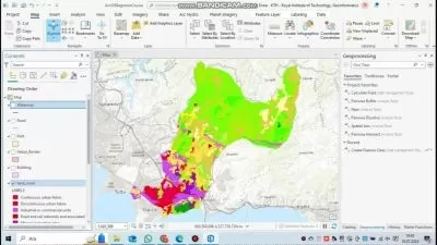
Third: In this section, there is an introduction to Geoprocessing, getting
acquainted with the Arctoolboox toolbox, training on the common Geoprocessing tools and how they work, and finally training on designing and
running geographical models to solve problems.
Fourth: This section is specific to spatial analysis, they include the basic
analysis (3D analysis, Network Analysis, Geostatistical Analysis, Hydrological
Analysis, Spatial Analysis and sit selection best location based on specific
criteria.
Fifth: the last section of course, in which training is conducted on the process of
formatting and producing maps, by training on the basic elements of map
layout, as well as making an atlas of maps.
Who this course is for:
- Engineers in survey, civil and Architecture
- Geographers, geologists, agriculturalists and fields related to earth sciences
Hello and Welcome to the practical course: Basics Geographic Information
Systems ( GIS ) completed ...
This course has been divided into five sections that aim to give the trainee the
basic skills to get professional in ArcGIS Desktop software, starting with
opening programs, adding data and layers and working with them, passing
through the process of editing and modification, then analysis spatial data
spatially of its various types, and finally Format and output data in the form of
maps.
The course divided into the following sections:
First: the basics of working with the program and getting to know user
interfaces, toolbars, menus, and display panels, then learn how to add data and
layers, working with them and symbology spatial data, as well as working whit
attribute table.
Second: In the second section, the topic of editing was discussed in detail,
starting with the basics and the toolbar for drawing and editing, and then
advanced operations such as geo-referencing, spatial adjustment, topology
corrections, operations for drawing and modifying banners and dimensions, the
process and operations of converting file formats to and from ArcGIS, as well
as explaining the performance of editing Automatically ArcScan .
Third: In this section, there is an introduction to Geoprocessing, getting
acquainted with the Arctoolboox toolbox, training on the common Geoprocessing tools and how they work, and finally training on designing and
running geographical models to solve problems.
Fourth: This section is specific to spatial analysis, they include the basic
analysis (3D analysis, Network Analysis, Geostatistical Analysis, Hydrological
Analysis, Spatial Analysis and sit selection best location based on specific
criteria.
Fifth: the last section of course, in which training is conducted on the process of
formatting and producing maps, by training on the basic elements of map
layout, as well as making an atlas of maps.
Who this course is for:
- Engineers in survey, civil and Architecture
- Geographers, geologists, agriculturalists and fields related to earth sciences
User Reviews
Rating

Eng. Geospatial
Instructor's Courses
Udemy
View courses Udemy- language english
- Training sessions 28
- duration 11:53:11
- Release Date 2024/04/29