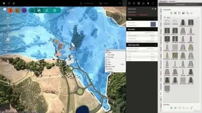
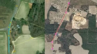
AutoCAD Civil 3D Topographic and Boundary Survey
Murad Farooq
4:25:27
Description
A Complete course for beginners an advance Professional Level
What You'll Learn?
- Topographic and Boundary Survey Drawings Prepartion
- Equipment Databases, Figure Prefix Databases, Linework Code Sets
- Setting Survey Databases,
- Field to Finish
- Detailed Filed Data Explaintion
- Creating TIN Surfaces
- Translating Survey
- Balancing Traverse
- Productiviy Tips and Tricks
- Introduction to Parcels
- Introduction to Points
- Topographic Data, Field Data, Field Codes
- How to Install Survey database support files
- Measuring tools in AutoDesk Civil 3D
Who is this for?
What You Need to Know?
More details
DescriptionYou can maintain consistent data and improve project performance with the help of the features and tools provided by AutoCAD Civil 3D software, a design and documentation solution for civil engineering. Learn how to use this powerful software to deal with every task involved in a survey project, such as boundary analysis and generating TIN surfaces, in this course. Murad Farooq, your instructor, takes you through the process of creating your survey database to get you going. In addition, he shows how to translate surveys, draw and mark boundaries, and construct automatic linework. He gives some excellent productivity tips at the end of the course.
Significant Highlights of the Course:
Introduction
1. 1-Welcome
2. What to Know
3. Exercise Files
Getting Started
1. Topographic Data, Filed data, and codes
2. Drawing or Survey
3. How to Set up Survey Database
4. Point Style and Points Properties
Field to Finish
1. Explain Filed to Finish Workflow
2. Description: Key sets
3. Figure prefix database
4. Linework code sets
5. Creating Automatic Linework
6. How to install the Support file for the survey database on the machine
Explain Points Completely Detailed
1. Points introduction
2. MANUAL POINTS
3. Create Points on Polyline
4. POINT EDITING
5. IMPORT POINTS GROUP, Part-1
6. POINTS GROUP, Part 2
7. Points group settings
About The TIN Surfaces
1. Introduction to TIN Surfaces
2. Adding definition to The Surface
3. Quality Checks
4. Surface Boundaries
5. Create Surface from CSV File
6. Delete Extra lines From the Surface
7. Change Contour Smoothing and contour intervals
8. Surface Style
9. Create a surface from 3D points polyline AutoCAD points and DEM
10. Add surface labels
11. Grid on Surface
12. Surface Analysis
13. Surface Analysis Table
14. Export and Import surfaces
Boundary Survey in Autodesk Civil 3D
1. How to Draw a Boundary
2. How to Label a Boundary
3. Creating tags and tag tables
4. Creating PARCEL
5. Map Check
6. Balancing a Traverse
7. Create Reports
Introduction to Parcels:
What are parcels?
Parcel properties and labels
Parcels Subdivide and Slide line
Edit Slide Line
Swingline and Swingline Eidt
Free Form and other options
Parcel Union & Dissolve
Parcels Table and Table Settings
Parcel details report and table data export
Productivity Tips and Tricks
Grips in Civil 3D
Measuring tools in AutoDesk Civil 3D
Area calculations in AutoDesk Civil 3D
Centerline and Center mark
Panorama Window
Transparent Command
Inquiry tool
Who this course is for:
- Anyone wishing to learn AutoCAD Civil 3D or Topographic Surveying
- Survey Engineering students
- Civil Engineering Students
You can maintain consistent data and improve project performance with the help of the features and tools provided by AutoCAD Civil 3D software, a design and documentation solution for civil engineering. Learn how to use this powerful software to deal with every task involved in a survey project, such as boundary analysis and generating TIN surfaces, in this course. Murad Farooq, your instructor, takes you through the process of creating your survey database to get you going. In addition, he shows how to translate surveys, draw and mark boundaries, and construct automatic linework. He gives some excellent productivity tips at the end of the course.
Significant Highlights of the Course:
Introduction
1. 1-Welcome
2. What to Know
3. Exercise Files
Getting Started
1. Topographic Data, Filed data, and codes
2. Drawing or Survey
3. How to Set up Survey Database
4. Point Style and Points Properties
Field to Finish
1. Explain Filed to Finish Workflow
2. Description: Key sets
3. Figure prefix database
4. Linework code sets
5. Creating Automatic Linework
6. How to install the Support file for the survey database on the machine
Explain Points Completely Detailed
1. Points introduction
2. MANUAL POINTS
3. Create Points on Polyline
4. POINT EDITING
5. IMPORT POINTS GROUP, Part-1
6. POINTS GROUP, Part 2
7. Points group settings
About The TIN Surfaces
1. Introduction to TIN Surfaces
2. Adding definition to The Surface
3. Quality Checks
4. Surface Boundaries
5. Create Surface from CSV File
6. Delete Extra lines From the Surface
7. Change Contour Smoothing and contour intervals
8. Surface Style
9. Create a surface from 3D points polyline AutoCAD points and DEM
10. Add surface labels
11. Grid on Surface
12. Surface Analysis
13. Surface Analysis Table
14. Export and Import surfaces
Boundary Survey in Autodesk Civil 3D
1. How to Draw a Boundary
2. How to Label a Boundary
3. Creating tags and tag tables
4. Creating PARCEL
5. Map Check
6. Balancing a Traverse
7. Create Reports
Introduction to Parcels:
What are parcels?
Parcel properties and labels
Parcels Subdivide and Slide line
Edit Slide Line
Swingline and Swingline Eidt
Free Form and other options
Parcel Union & Dissolve
Parcels Table and Table Settings
Parcel details report and table data export
Productivity Tips and Tricks
Grips in Civil 3D
Measuring tools in AutoDesk Civil 3D
Area calculations in AutoDesk Civil 3D
Centerline and Center mark
Panorama Window
Transparent Command
Inquiry tool
Who this course is for:
- Anyone wishing to learn AutoCAD Civil 3D or Topographic Surveying
- Survey Engineering students
- Civil Engineering Students
User Reviews
Rating
Murad Farooq
Instructor's Courses
Udemy
View courses Udemy- language english
- Training sessions 53
- duration 4:25:27
- Release Date 2023/12/05


