ArcGIS Pro - Learn easy!
AulaGEO Academy,Golgi Alvarez
2:28:16
- 1 - aeropuertos
- aeropuertos.shp.zip
- aeropuertos.zip
- 14 - Resultado-importar-cad-a-gis
- estructuras.shp.zip
- estructuras.zip
- parcelas polygon.shp.zip
- parcelas polygon.zip
- rios.shp.zip
- rios.zip
- shp
Description
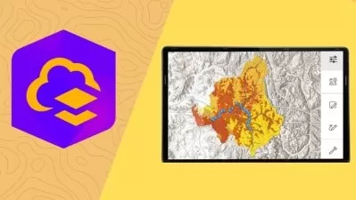
ArcGIS Pro is the new version of ArcMap
What You'll Learn?
- Learn ArcGIS Pro from zero
- Create, import data, analyze and generate final maps
- Learn doing, through step by step use cases - All in the same environment of data.
- Learn doing, through step by step use cases - All in the same environment of data.
- Advanced ArcGIS Pro: Imagery, LiDAR data, Geodatabase, Story Maps, Layouts
Who is this for?
What You Need to Know?
More details
DescriptionCourse Description:
Learn how to use the tools provided by ArcGIS Pro, starting from scratch.
This course include, the basic of ArcGIS Pro; data edition, methods to selection of spatial data based in attributes and location and creation of bookmarks.  Then, we include digitization of shapefiles, addition and digitizing layers, editing attribute and column attributes.
What will the user learn?
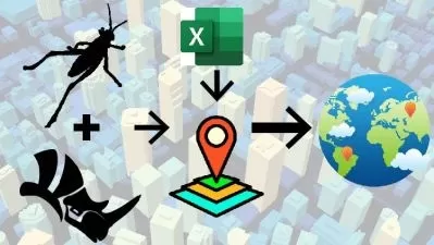
You will learnt to use symbology within features and labeling of points, lines and polygons. Includes buffer analyisis, import of Excel data and georeference of images. #AulaGEO
To share data you will learn how to share data online and generate final maps.
Includes step by step excercises in the AulaGEO environment.
This course includes:
The basic with ArcGIS Pro
Clase 1: Let´s start with the ArcGIS Pro
Clase 2: Data selection
Clase 3: Use bookmarks
Creating and editing spatial data
Clase 4: Import data from Excel
Clase 5: Symbology data
Clase 6: Editing of attribute data
Clase 7: Labeling features
Clase 8: Digitization of geographic information
Clase 9: Georeferencing of images
Analysis data
Clase 10: Buffer analysis
Publishing contents from ArcGIS Pro
Clase 11: Map generation
Let´s do it in AulaGEO - step by step excercises
Clase 13: Implications of the change from ArcMap to ArcGIS Pro
Clase 14: Exercise 1. Import CAD data to GIS
Clase 15: Exercise 2. Import coordinates from Excel for split a polygon
Clase 16: Exercise 3. Calculation of areas and composition of calculated fields
Clase 17: Exercise 4. Buffer Analysis
Clase 18: Exercise 5. Attribute labeling
Clase 19: Exercise 6. Thematization by attributes
Clase 20: Exercise 7. Digitization tricks
Clase 21: Exercise 8. Gereferencing images
Who this course is for:
- Everyone who wants to improve their profile and expand their opportunities in geospatial design and analysis.
- GIS users which have used ArcGIS Desktop versions and want to learn how to do the process with ArcGIS Pro
- Enthusiasts and users of Geographic Information Systems
Course Description:
Learn how to use the tools provided by ArcGIS Pro, starting from scratch.
This course include, the basic of ArcGIS Pro; data edition, methods to selection of spatial data based in attributes and location and creation of bookmarks.  Then, we include digitization of shapefiles, addition and digitizing layers, editing attribute and column attributes.
What will the user learn?
You will learnt to use symbology within features and labeling of points, lines and polygons. Includes buffer analyisis, import of Excel data and georeference of images. #AulaGEO
To share data you will learn how to share data online and generate final maps.
Includes step by step excercises in the AulaGEO environment.
This course includes:
The basic with ArcGIS Pro
Clase 1: Let´s start with the ArcGIS Pro
Clase 2: Data selection
Clase 3: Use bookmarks
Creating and editing spatial data
Clase 4: Import data from Excel
Clase 5: Symbology data
Clase 6: Editing of attribute data
Clase 7: Labeling features
Clase 8: Digitization of geographic information
Clase 9: Georeferencing of images
Analysis data
Clase 10: Buffer analysis
Publishing contents from ArcGIS Pro
Clase 11: Map generation
Let´s do it in AulaGEO - step by step excercises
Clase 13: Implications of the change from ArcMap to ArcGIS Pro
Clase 14: Exercise 1. Import CAD data to GIS
Clase 15: Exercise 2. Import coordinates from Excel for split a polygon
Clase 16: Exercise 3. Calculation of areas and composition of calculated fields
Clase 17: Exercise 4. Buffer Analysis
Clase 18: Exercise 5. Attribute labeling
Clase 19: Exercise 6. Thematization by attributes
Clase 20: Exercise 7. Digitization tricks
Clase 21: Exercise 8. Gereferencing images
Who this course is for:
- Everyone who wants to improve their profile and expand their opportunities in geospatial design and analysis.
- GIS users which have used ArcGIS Desktop versions and want to learn how to do the process with ArcGIS Pro
- Enthusiasts and users of Geographic Information Systems
User Reviews
Rating

AulaGEO Academy
Instructor's Courses
Golgi Alvarez
Instructor's Courses
Udemy
View courses Udemy- language english
- Training sessions 20
- duration 2:28:16
- English subtitles has
- Release Date 2024/05/04