ArcGIS Pro for Beginners — Learn Map Making Step-By-Step
Omasan Akporiaye
39:39
Description
Go from zero to indispensable to any company with these simple, clear, & time-tested ArcGIS Pro map-making techniques
What You'll Learn?
- Download & install ArcGIS Pro and setup an ArcGIS Online account.
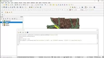
- Setup a project and navigate the ArcGIS Pro interface.
- Prepare spreadsheet data for use in GIS.
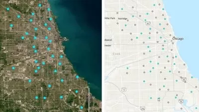
- Learn the quickest way to add data to your ArcGIS Pro project.
- Add data from ESRI’s Living Atlas of the world into your map.
- Investigate attribute information of data, to determine the best symbology method to apply.
- Join spreadsheet data to a feature layer in ArcGIS Pro
- Symbolize data using ArcGIS Pro’s quantitative classification methods and statistical breakpoints in your data.
- Create a map layout with north arrows, scale bar and dynamic map text elements.
- Modify the basemap to improve visualisation of data.
- Export a map layout to printable hard copy.
- Share your data as a web feature layer.
Who is this for?
More details
DescriptionAre you looking to learn ArcGIS Pro for enhancing your career skills?
If you are, but…
You find that most spatial data analysis content & manuals available online are vague.
There are no courses that actually teach you how to be productive with ArcGIS Pro and get a job in the field of GIS and geospatial analysis.
You’re frustrated with the steep learning curve and the time required to identify the necessary skills and knowledge to perform GIS workflows.
Available resources are expensive and you can’t afford them because you’re a student or at the start of your career.
You are not sure if being proficient with ArcGIS Desktop is a career-enhancing skill for the field of ecology, quantitative social sciences, hydrology, civil engineering, or geography.
Free Online Tutorials have left you more confused than before and you don’t have a clear idea of how to do map-making at a professional level.
Well, guess what? You’re come to the right place. And this course was designed specifically to help you overcome all of these challenges.
My name is Omasan And I’ll be teaching you this course. A little bit about me…I’m a Geospatial Data Scientist with over 13 years of experience using geospatial technologies. And my experience ranges from Counter-Narcotic Monitoring and Humanitarian Mapping to Engineering & Environmental Consultancy.
I have been where you are right now. Confused about where and how to start learning ArcGIS so I can find a job. Even after exhausting all the available resources at that time…I didn’t know how to identify component parts of the ArcGIS platform and how they would fit together in order to create my first set of maps.
I had to discover and combine all the pieces together myself to become a skilful person who employers actually want to hire. After over 13 years of being an industry expert, I still see students or new graduates facing this challenge.
Now you guys may have access to more resources than I had, but I’ve experienced that…Tons of GIS information available online is simply not effective in the professional world.
Individuals get overwhelmed and waste their time consuming these resources without getting any structural approach to master ArcGIS Pro.
After experiencing this frustration among students… I decided to launch this course and help individuals like yourself to learn ArcGIS Pro at a professional level.
Before you get all excited…Let me tell you WHO SHOULDN’T ENROL in this course.
If you already have intermediate to advanced knowledge of Geographic Information Systems, their processes, and the geospatial industry…
Then, you should opt for another course.
However, if you’re a BEGINNER…
In this short course, we together will aim to set a strong foundation for GIS and give you clear step-by-step instructions on how to set up your ArcGIS Pro project, create, export, and share your first map.
You’ll be given practical how-to tips on working with GIS, specifically with the ArcGIS Pro Desktop GIS software package. The aim of this course is to equip entry-level to mid-level GIS users, with basic skills.
And knowledge to identify and implement best practices for working with the ArcGIS Platform.
AT THE END OF THIS COURSE…
You’ll not have to waste your time anymore going through all the noise available online. Because after this course you’ll have the essential skills required to introduce yourself to the market.
You’ll go from not knowing what GIS is to having a high-level understanding of its component parts as well as gaining hands-on experience with ArcGIS Pro Desktop software.
I WOULD SUGGEST THAT…
You should take this course in order so you can learn a step-by-step approach.
You should have a Basic Level License of ArcGIS Desktop license (which includes ArcGIS Pro) in order to complete all exercises. (instructions are included for you to get a 21-day free trial of ArcGIS Pro.)
If you want to take yourself from Zero to becoming Indispensable for your employer…
You can take advantage of this course and ENROL TODAY! I’ll personally provide you with assistance and ensure your experience with this course is a success.
And if you get overwhelmed or stuck, you’ll surely find me at your side answering all your questions and nudging you in the right direction.
After over 13 years of being a Geospatial Data Scientist and teaching experience…I can assure you that this is the most hands-on knowledge and real-time practical exercise you can get when it comes to learning how to make maps using ArcGIS Pro.
ENROL TODAY and START your career the right way.
Disclaimer: If you’re unsatisfied with the course (which I strongly doubt!), there is a 30-day money-back guarantee.
Who this course is for:
- Anyone who is interested in learning about GIS and ArcGIS can take this course.
- Researchers, Academics, Conservation Managers, Field Ecologists, and Social Scientists.
- Students & Recent Graduates of Geography, Environmental Sciences, Geology, Hydrology, Engineering, Earth Sciences, and Ecology.
- GIS entry-level to mid-level professionals who want to learn ArcGIS Pro fast and don’t have enough time to spare.
Are you looking to learn ArcGIS Pro for enhancing your career skills?
If you are, but…
You find that most spatial data analysis content & manuals available online are vague.
There are no courses that actually teach you how to be productive with ArcGIS Pro and get a job in the field of GIS and geospatial analysis.
You’re frustrated with the steep learning curve and the time required to identify the necessary skills and knowledge to perform GIS workflows.
Available resources are expensive and you can’t afford them because you’re a student or at the start of your career.
You are not sure if being proficient with ArcGIS Desktop is a career-enhancing skill for the field of ecology, quantitative social sciences, hydrology, civil engineering, or geography.
Free Online Tutorials have left you more confused than before and you don’t have a clear idea of how to do map-making at a professional level.
Well, guess what? You’re come to the right place. And this course was designed specifically to help you overcome all of these challenges.
My name is Omasan And I’ll be teaching you this course. A little bit about me…I’m a Geospatial Data Scientist with over 13 years of experience using geospatial technologies. And my experience ranges from Counter-Narcotic Monitoring and Humanitarian Mapping to Engineering & Environmental Consultancy.
I have been where you are right now. Confused about where and how to start learning ArcGIS so I can find a job. Even after exhausting all the available resources at that time…I didn’t know how to identify component parts of the ArcGIS platform and how they would fit together in order to create my first set of maps.
I had to discover and combine all the pieces together myself to become a skilful person who employers actually want to hire. After over 13 years of being an industry expert, I still see students or new graduates facing this challenge.
Now you guys may have access to more resources than I had, but I’ve experienced that…Tons of GIS information available online is simply not effective in the professional world.
Individuals get overwhelmed and waste their time consuming these resources without getting any structural approach to master ArcGIS Pro.
After experiencing this frustration among students… I decided to launch this course and help individuals like yourself to learn ArcGIS Pro at a professional level.
Before you get all excited…Let me tell you WHO SHOULDN’T ENROL in this course.
If you already have intermediate to advanced knowledge of Geographic Information Systems, their processes, and the geospatial industry…
Then, you should opt for another course.
However, if you’re a BEGINNER…
In this short course, we together will aim to set a strong foundation for GIS and give you clear step-by-step instructions on how to set up your ArcGIS Pro project, create, export, and share your first map.
You’ll be given practical how-to tips on working with GIS, specifically with the ArcGIS Pro Desktop GIS software package. The aim of this course is to equip entry-level to mid-level GIS users, with basic skills.
And knowledge to identify and implement best practices for working with the ArcGIS Platform.
AT THE END OF THIS COURSE…
You’ll not have to waste your time anymore going through all the noise available online. Because after this course you’ll have the essential skills required to introduce yourself to the market.
You’ll go from not knowing what GIS is to having a high-level understanding of its component parts as well as gaining hands-on experience with ArcGIS Pro Desktop software.
I WOULD SUGGEST THAT…
You should take this course in order so you can learn a step-by-step approach.
You should have a Basic Level License of ArcGIS Desktop license (which includes ArcGIS Pro) in order to complete all exercises. (instructions are included for you to get a 21-day free trial of ArcGIS Pro.)
If you want to take yourself from Zero to becoming Indispensable for your employer…
You can take advantage of this course and ENROL TODAY! I’ll personally provide you with assistance and ensure your experience with this course is a success.
And if you get overwhelmed or stuck, you’ll surely find me at your side answering all your questions and nudging you in the right direction.
After over 13 years of being a Geospatial Data Scientist and teaching experience…I can assure you that this is the most hands-on knowledge and real-time practical exercise you can get when it comes to learning how to make maps using ArcGIS Pro.
ENROL TODAY and START your career the right way.
Disclaimer: If you’re unsatisfied with the course (which I strongly doubt!), there is a 30-day money-back guarantee.
Who this course is for:
- Anyone who is interested in learning about GIS and ArcGIS can take this course.
- Researchers, Academics, Conservation Managers, Field Ecologists, and Social Scientists.
- Students & Recent Graduates of Geography, Environmental Sciences, Geology, Hydrology, Engineering, Earth Sciences, and Ecology.
- GIS entry-level to mid-level professionals who want to learn ArcGIS Pro fast and don’t have enough time to spare.
User Reviews
Rating

Omasan Akporiaye
Instructor's Courses
Udemy
View courses Udemy- language english
- Training sessions 12
- duration 39:39
- Release Date 2022/12/13