ArcGIS: ArcGIS from Beginner to Advanced Level
Ajit Kumar Swain
5:21:14
Description
Master the Essentials and Advanced Techniques of GIS Mapping and Spatial Analysis
What You'll Learn?
- GIS, ArcGIS, ArcCatalog
- ArcMap Basics
- GIS Data Acquisition and Georeferencing
- Digitization and Components of Maps
- Working with Attribute Table
- Working with Symbology
- Professional Map Layout
- Buffer, Clipping
- Union, Intersection
- Merge, Dissolve
- Adding Excel data to Layers
- Join and Relate
- Data Transformation and Conversion
- Downloading Satellite Data
- Image Interpretation
- Pre-Processing
- NDVI and NDWI
- Map Algebra
- Supervised Image Classification
- Un-Supervised Image Classification
Who is this for?
What You Need to Know?
More details
DescriptionUnlock the full potential of Geographic Information Systems (GIS) with our comprehensive ArcGIS course designed for learners at all levels. Whether you're just starting out or looking to refine your skills, this course provides a thorough grounding in both the basics and advanced functionalities of ArcGIS.
What You Will Learn:
ArcGIS, GIS, Spatial Analysis: Understand the core concepts of GIS and their practical applications.
ArcMap Basics: Get familiar with the ArcMap interface and essential tools.
Geoprocessing: Learn to perform spatial data manipulation and analysis.
Use of ArcCatalog: Efficiently manage and organize your spatial data.
Map Making: Create professional and visually appealing maps.
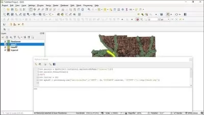
Map Digitization: Convert paper maps into accurate digital formats.
Basics and Tasks of Shapefile: Understand and work with shapefiles, a fundamental GIS data format.
Basics and Tasks of Raster Files: Explore raster data and its applications.
Shapefile Creation: Step-by-step guide to creating shapefiles.
Raster File Processing: Learn to create and analyze raster files.
Course Requirements:
Basic computer skills.
Access to ArcGIS Desktop (ArcMap, ArcCatalog)
A stable internet connection.
An interest in GIS and mapping.
Who This Course is For:
Beginners in GIS: Start from the basics and advance at your own pace.
Students and Academics: Gain practical skills to complement your studies.
Professionals Seeking GIS Skills: Enhance your career with valuable GIS knowledge.
Researchers and Analysts: Apply spatial analysis techniques to your projects.
GIS Enthusiasts: Deepen your understanding of GIS and mapping.
Career Changers: Transition into a GIS-related career with confidence.
Technical Specialists: Integrate GIS capabilities into your technical skillset.
Join us on this journey from beginner to advanced level and become proficient in using ArcGIS for a wide range of applications. Enroll now and start mastering the essentials and advanced techniques of GIS mapping and spatial analysis.
Who this course is for:
- Beginners in GIS
- Students and Academics:
- Professionals Seeking GIS Skills
- Researchers and Analysts
- GIS Enthusiasts
- Career Changers
- Technical Specialists
Unlock the full potential of Geographic Information Systems (GIS) with our comprehensive ArcGIS course designed for learners at all levels. Whether you're just starting out or looking to refine your skills, this course provides a thorough grounding in both the basics and advanced functionalities of ArcGIS.
What You Will Learn:
ArcGIS, GIS, Spatial Analysis: Understand the core concepts of GIS and their practical applications.
ArcMap Basics: Get familiar with the ArcMap interface and essential tools.
Geoprocessing: Learn to perform spatial data manipulation and analysis.
Use of ArcCatalog: Efficiently manage and organize your spatial data.
Map Making: Create professional and visually appealing maps.
Map Digitization: Convert paper maps into accurate digital formats.
Basics and Tasks of Shapefile: Understand and work with shapefiles, a fundamental GIS data format.
Basics and Tasks of Raster Files: Explore raster data and its applications.
Shapefile Creation: Step-by-step guide to creating shapefiles.
Raster File Processing: Learn to create and analyze raster files.
Course Requirements:
Basic computer skills.
Access to ArcGIS Desktop (ArcMap, ArcCatalog)
A stable internet connection.
An interest in GIS and mapping.
Who This Course is For:
Beginners in GIS: Start from the basics and advance at your own pace.
Students and Academics: Gain practical skills to complement your studies.
Professionals Seeking GIS Skills: Enhance your career with valuable GIS knowledge.
Researchers and Analysts: Apply spatial analysis techniques to your projects.
GIS Enthusiasts: Deepen your understanding of GIS and mapping.
Career Changers: Transition into a GIS-related career with confidence.
Technical Specialists: Integrate GIS capabilities into your technical skillset.
Join us on this journey from beginner to advanced level and become proficient in using ArcGIS for a wide range of applications. Enroll now and start mastering the essentials and advanced techniques of GIS mapping and spatial analysis.
Who this course is for:
- Beginners in GIS
- Students and Academics:
- Professionals Seeking GIS Skills
- Researchers and Analysts
- GIS Enthusiasts
- Career Changers
- Technical Specialists
User Reviews
Rating

Ajit Kumar Swain
Instructor's Courses
Udemy
View courses Udemy- language english
- Training sessions 60
- duration 5:21:14
- Release Date 2024/07/26